Extensive map material for the Test Area Autonomous Driving Baden-Württemberg
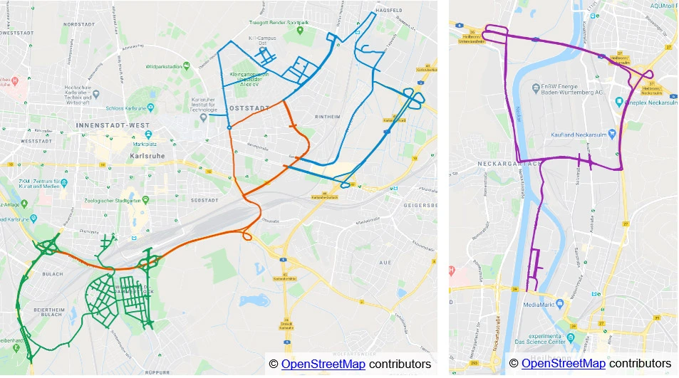
In recent months, further sections of the Test Area Autonomous Driving Baden-Württemberg have been mapped in the Weiherfeld-Dammerstock area in Karlsruhe. Already in the initial phase, a large number of routes of the test area in Karlsruhe and Heilbronn were shown on maps. With the new sections, highly accurate maps of routes representing an urban traffic area are now also available.
This means that the test area has mapped route sections with all types of public roads. The map material currently comprises a total of 261 km of lanes, 265 traffic signals, 116 posts and 801 traffic signs. The length of annotated lane boundaries includes 104 km with kerbs and 271 km with lane markings. Users of the test area have the opportunity to use sections of the motorways A5 and A6 including slip roads and exits, federal roads and country roads as well as inner-city areas (Karlsruhe Oststadt, Heilbronn) and rural areas (Weiherfeld-Dammerstock).
More information can be found in the service catalogue of the Test Area Autonomous Driving.